There is a very efficient way to drive from San Francisco to Los Angeles.
This isn’t it.
Interstate 5 will move you between California’s two great cities with the sort of ruthless competence normally associated with airports and tax software. Highway 1, by contrast, keeps finding reasons to stop.
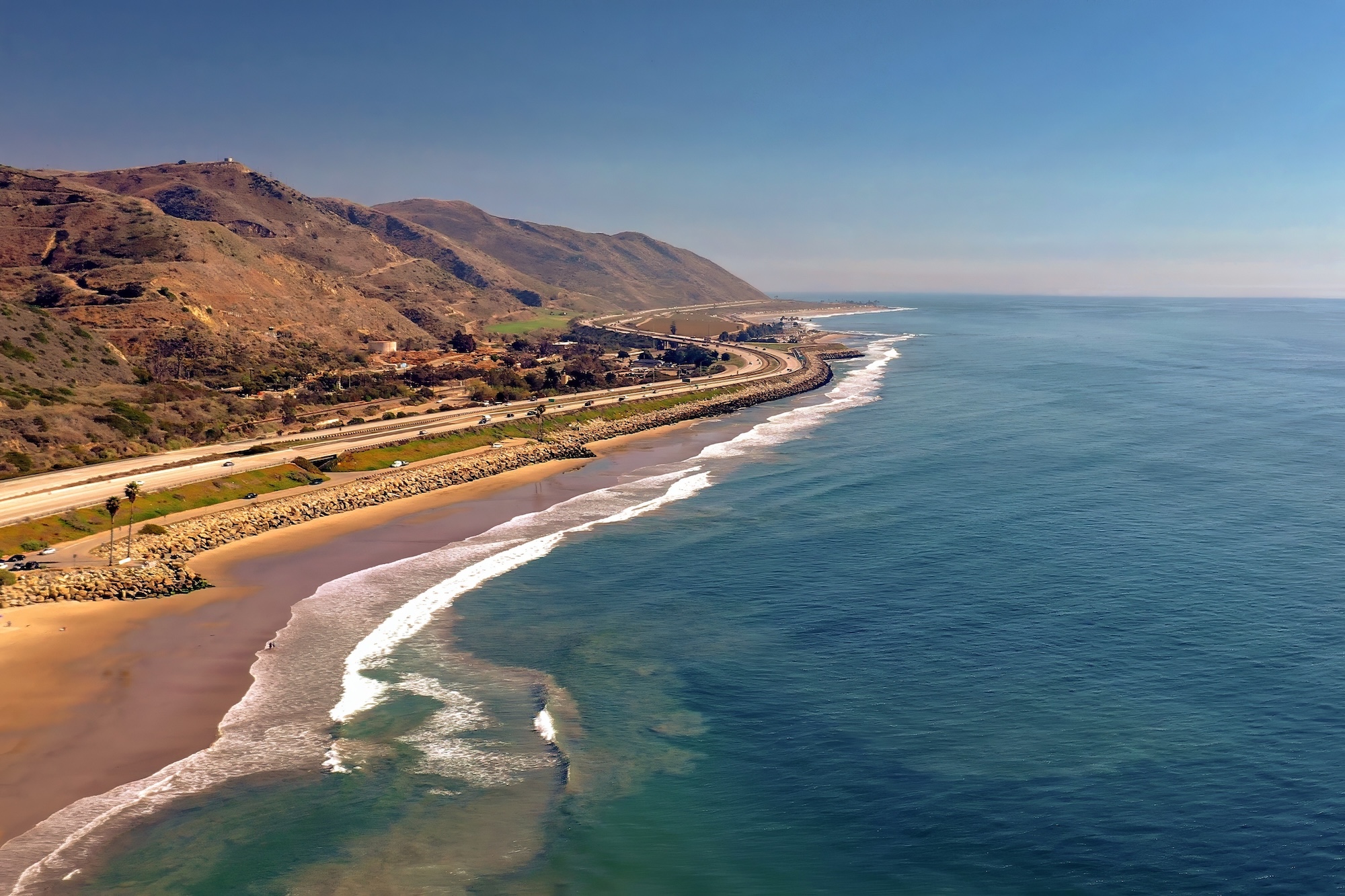
A beach appears below the cliffs. Then a lighthouse. Then a town that seems to have been arranged specifically for lunch. Then the road climbs, the Pacific fills the windscreen and whatever schedule you had begins to look increasingly stupid.
This is the great trick of the Pacific Coast Highway.
On a map, San Francisco and Los Angeles don’t look terribly far apart. On the coast, they contain several days’ worth of California.
You can drive the route quickly.
You shouldn’t.
First, a small problem with the name
“Pacific Coast Highway” is wonderfully evocative and slightly imprecise.
California State Route 1 runs for more than 650 miles along much of the state’s coast, from Orange County in Southern California to Mendocino County in the north. Different sections acquire different names, and not every mile between San Francisco and Los Angeles follows the shoreline.
But when travellers imagine the classic Pacific Coast Highway road trip, this is usually the journey they mean: San Francisco south through Santa Cruz, Monterey, Carmel, Big Sur, San Simeon, the Central Coast and Santa Barbara before reaching Los Angeles.
And southbound is the way we’d drive it.
Not because northbound is somehow inferior, but because travelling south puts the Pacific on your side of the road. The turnouts are easier, the coastal views arrive without looking across opposing traffic and the journey feels as though California is slowly unfolding in front of you.
Just don’t interpret “Pacific on your side” as permission to stop wherever you like.
At Bixby Bridge, for example, obey the current stopping and parking restrictions rather than crawling along while everyone in the car attempts to manufacture the perfect photograph.
The ocean will still be there.
Keep driving.
Pacific Coast Highway at a glance
Route: San Francisco to Los Angeles via California Highway 1 and the Central Coast
Best trip length: 4–6 days
Minimum we’d recommend: 3 days
Direction: Southbound
Best for: Coastline, small towns, photography, food and a road that is actually part of the holiday
Don’t assume: Highway 1 will always be fully open
Before leaving: Check Caltrans road conditions and park closures
Highway 1 has a habit of reminding people that cliffs, wildfire, rain and geology do not care about itineraries.
Highway 1 has repeatedly been affected by landslides, storms and wildfires, sometimes making a through journey along the Big Sur coast impossible for months or even years at a time.
Even when the highway itself is open, individual parks, trails and attractions can remain closed or operate with restricted access.
That isn’t an argument against driving it.
It’s an argument for checking the road before you do.
Check current Highway 1 conditions with Caltrans before departure.
Day 1: San Francisco to Monterey
The temptation is to leave San Francisco and immediately begin chasing Big Sur.
Resist it.
The coast south of the city is already doing interesting things.
Highway 1 carries you through Pacifica and Half Moon Bay, where metropolitan California begins loosening its grip. Development thins, cliffs appear and the Pacific starts behaving less like scenery and more like a travelling companion.
Take your time through this section.
Pescadero makes a good diversion. Santa Cruz can consume anything from an hour to most of a day depending on your tolerance for amusement parks, surf culture and watching other people surf considerably better than you ever will.
Then continue around Monterey Bay.
Monterey itself is worth the night rather than a fuel stop. The old waterfront, Cannery Row and the peninsula give the trip some historical texture before the landscape becomes much more dramatic farther south.
If you have another day to spare, this is also where the schedule can profitably expand.
Monterey and neighbouring Carmel are not obstacles between San Francisco and Big Sur.
They’re part of the road trip.
Day 2: Monterey to Big Sur
This is the day the photographs have been promising.
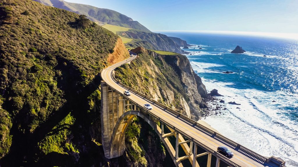
Leave Monterey, pass Carmel and Highway 1 begins working its way into the landscape most people have been picturing since they booked the flight.
The Santa Lucia Mountains crowd towards the Pacific. The road finds the narrow territory between them.
Then comes Bixby Bridge.
Then cliffs.
Then redwoods.
Then another corner that appears to improve upon the previous corner.
Big Sur is generally described as a roughly 90-mile stretch of coastline between Carmel and the San Simeon area. That sounds manageable until you actually get there.
This is not 90 miles to dispatch before lunch.
It is 90 miles capable of consuming a day.
The road itself is the attraction, but the surrounding parks and trails make the strongest argument for slowing down. Depending on current access, possibilities include Point Sur, Pfeiffer Big Sur, Julia Pfeiffer Burns and Limekiln.
McWay Falls is the celebrity. Redwood groves provide the counterargument to spending the entire day staring west.
And somewhere in between, stop for lunch.
The great danger with Big Sur is turning it into a checklist:
Bixby Bridge. Photograph.
McWay Falls. Photograph.
Ocean. Photograph.
Next.
Don’t.
Sit somewhere for a while. Walk when access permits. Watch fog move through the hills. Have an unnecessarily long lunch overlooking the Pacific.
You didn’t come all this way to prove that your rental car can maintain an average speed.
Day 3: Big Sur to San Luis Obispo
This is where the coast changes character again.
South of Big Sur, the mountains gradually surrender some space. The road approaches San Simeon, where one of America’s most extravagant houses sits on a hill above the Pacific.
Hearst Castle is not a subtle building.
William Randolph Hearst and architect Julia Morgan spent decades creating an estate that eventually grew to 165 rooms, surrounded by more than 100 acres of gardens, terraces, pools and walkways. Today it forms the Hearst San Simeon State Historical Monument and is open to visitors through guided tours.
Even if enormous private estates aren’t usually your thing, this one earns its interruption.
Then, almost immediately, California provides an entirely different spectacle for free.
At Piedras Blancas, northern elephant seals gather beside Highway 1. Depending on the season, the colony can range from relatively quiet to a beach full of enormous animals arguing loudly about matters of great importance to elephant seals.
Continue through Cambria and Morro Bay, where Morro Rock provides one of those geographic landmarks that seems to keep reappearing no matter which street you turn down.
Spend the night around San Luis Obispo.
By now you should have realised the essential rule of this road:
The famous bit is not the only good bit.
Day 4: San Luis Obispo to Santa Barbara
This is the section people risk rushing because Big Sur is behind them.
That would be a mistake.
California’s Central Coast becomes gentler here, but not less interesting.
Depending on your interests, you can wander through beach towns, wine country or both. Pismo Beach provides the classic seaside option; the Santa Ynez Valley offers a worthwhile inland deviation if vineyards are more appealing than another hour of sand.
Then Santa Barbara arrives looking suspiciously pleased with itself.
Mountains behind it. Pacific in front. Spanish-influenced architecture. Palm trees apparently positioned by committee.
It is one of the places on this journey where staying overnight makes much more sense than arriving at 2pm, taking a photograph and leaving at 3.
Walk the waterfront. Explore downtown. Eat somewhere without looking at the clock.
The point of taking four or five days to reach Los Angeles is that you’re allowed to have evenings.
Day 5: Santa Barbara to Los Angeles
The final run is shorter, which is exactly how it should be.
Ventura gives you another chance to delay the inevitable return to serious traffic. Then Highway 1 heads towards Malibu, and Los Angeles begins announcing itself gradually rather than appearing all at once.
This is one of the great contrasts of the drive.
For days, the Pacific has been accompanied by cliffs, forests, farms and small towns.
Now it gets Malibu.
Beaches continue, but the urban pressure builds. Houses occupy improbable slopes. Traffic thickens. The road that felt almost impossibly wild around Big Sur becomes unmistakably Southern Californian.
And then comes Santa Monica.
There is no ceremonial finish line equivalent to completing Route 66. You simply arrive at the western edge of one of the world’s great cities with several hundred miles of California behind you.
Park the car.
Walk towards the ocean.
You’ve earned an evening without it.
Could you do it in three days?
Yes.
San Francisco to Monterey.
Monterey through Big Sur to San Luis Obispo.
San Luis Obispo to Los Angeles.
That is the minimum version we’d recommend if experiencing Highway 1 is genuinely part of the trip rather than merely moving between the cities.
Two days is possible when the road is open.
So is eating Christmas dinner in nine minutes.
Neither proves it was a good idea.
Four days is better. Five gives the journey room to breathe. Six lets you add hikes, Hearst Castle, longer meals, beach time or an extra night somewhere you discover you don’t particularly want to leave.
That’s when this drive starts becoming a road trip rather than a scenic transfer.
When should you drive Highway 1?
There is no single perfect month.
Spring can bring green hillsides and wildflowers. Summer offers long days but also crowds and the possibility of coastal fog. Autumn can be superb, with generally pleasant weather and fewer peak-summer travellers. Winter can produce spectacular clear days but also brings the greatest risk of storms, landslides and weather-related disruption.
Wildfire can also change conditions outside the traditional winter trouble period.
So the best time is partly seasonal and partly opportunistic.
Check conditions shortly before departure.
Then check them again.
Caltrans maintains live road information, and California State Parks publishes current restrictions affecting parks along Big Sur.
Highway 1 is a road where yesterday’s itinerary can become tomorrow’s detour.
The mistake is treating Big Sur as the whole story
Big Sur deserves its reputation.
The combination of mountains, Pacific, bridges, redwoods and a road draped along the edge of the continent is extraordinary.
But concentrating exclusively on those famous miles misses what makes the full San Francisco-to-Los Angeles journey so satisfying.
The landscape keeps changing.
So does California.
San Francisco gives way to coastal towns. Surf culture gives way to Monterey history. Monterey gives way to the improbable geography of Big Sur. Big Sur opens into ranch country and elephant-seal beaches. San Luis Obispo gives way to Santa Barbara polish. Then Malibu gradually introduces Los Angeles.
The road joins all of it.
That is why we wouldn’t rush Highway 1.
You can find faster ways between San Francisco and Los Angeles. California has spent billions of dollars making sure of it.
Take one of those if the destination is all that matters.
Take the coast when it isn’t.