California has a problem.
It has too much California in it.
You can leave Los Angeles beneath palm trees, stand among Joshua trees that afternoon, descend below sea level in Death Valley, walk beneath giant sequoias a few days later, stare up at Yosemite’s granite walls, eat dinner in San Francisco and eventually drive back to Los Angeles with the Pacific Ocean beside you.
All without leaving one state.
This creates an obvious temptation when planning a California road trip: try to see absolutely everything.
Don’t.
California is almost 800 miles from north to south. Its famous places are separated by mountains, deserts, agricultural valleys and metropolitan areas containing approximately nine billion cars.
A good two-week California road trip therefore isn’t the itinerary that includes the most pins on Google Maps.
It’s the one that gives the best places enough time to be worth reaching.
For a first major road trip from Los Angeles, this loop gives you an extraordinary cross-section of the state: Los Angeles → Joshua Tree → Death Valley → Sequoia → Yosemite → San Francisco → Monterey → Big Sur → San Luis Obispo → Santa Barbara → Los Angeles.
Desert. Mountains. Giant trees. Great cities. Highway 1. The Pacific.
Fourteen days.
One very large state.
And, crucially, no requirement to wake up every morning and immediately drive another 400 miles.
The route at a glance
- Start and finish: Los Angeles.
- Time: 14 days.
- Route: Los Angeles → Joshua Tree → Death Valley → Sequoia National Park → Yosemite National Park → San Francisco → Monterey/Carmel → Big Sur → San Luis Obispo → Santa Barbara → Los Angeles.
- Best time: Late spring and early-to-mid fall are generally the best compromises, but there is no single perfect season for every part of this route.
- Driving: Expect roughly 1,500 miles once local exploring and detours are included.
- Biggest driving day: Death Valley to the Sequoia area.
- Best road: Highway 1 through Big Sur when fully open.
- Worst idea: Attempting Death Valley as though July were merely February with better lighting.
- The rule: Two weeks is enough to see California. It is not enough to collect California — That distinction will save the trip.
When is the best time for a California road trip?
This itinerary contains its own climate disagreement.
Joshua Tree and Death Valley are deserts. Yosemite and Sequoia rise into the Sierra Nevada. San Francisco can make July feel suspiciously like November. The Central Coast then goes back to behaving like California.
For the complete loop, late spring and early-to-mid fall are generally the best compromises — but no month perfectly suits every stop.
April and May can be excellent in the desert and on the coast, while snow may still limit some higher Sierra roads. September and October generally offer easier Sierra access, but Death Valley can remain dangerously hot.
Death Valley can already be seriously hot in late spring and early fall. The National Park Service warns that summer temperatures can reach 130°F (54°C) and specifically advises against hiking at low elevations during hot conditions.
At the other extreme, snow can affect Sierra roads well into spring and return in fall.
Yosemite’s Tioga Road is a good illustration of the problem. Its opening and closing dates depend on snow. Spring plowing generally begins around April 15 and can take one to two months, while the road closes again when snow returns in fall.
In 2026, Tioga Road opened unusually early on May 15 — its earliest opening in 16 years.
Fortunately, this particular loop does not depend on Tioga Road. It approaches Yosemite from the western side, making it much more robust across the shoulder seasons.
If you’re doing the trip in the height of summer, I’d seriously consider removing Death Valley and giving the extra day to Yosemite, Sequoia or the coast.
Death Valley is magnificent.
It will still be there when it stops trying to cook you.
Day 1: Los Angeles
Sleep: Los Angeles
Do not land at Los Angeles International Airport after a 14-hour flight, collect an unfamiliar rental car and immediately begin a six-hour road trip.
California will wait until tomorrow.
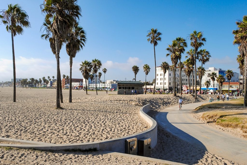
Use the first day for Los Angeles.
Exactly what that means depends on what version of Los Angeles you want. Santa Monica and Venice make sense if the Pacific is the priority. Griffith Observatory gives you the city from above. Hollywood answers several questions you may have had about Hollywood, including whether Hollywood Boulevard looks exactly as glamorous as you imagined.
It does not.
That’s part of the experience.
The important thing is not to turn Day 1 into a complete Los Angeles itinerary. This road trip ends here too, so anything you miss can be picked up later.
Recover.
Eat.
Look at some palm trees.
Try to remember which side of the rental car the fuel cap is on.
Tomorrow California gets bigger.
Day 2: Los Angeles to Joshua Tree
Sleep: Joshua Tree, Yucca Valley or Twentynine Palms
The transition from Los Angeles to the desert is one of the reasons this loop works so well.
A few hours after leaving one of America’s largest metropolitan areas, you’re among enormous boulders, open desert and trees that appear to have been designed during a meeting at which nobody was prepared to tell the tree it had become ridiculous.
Joshua Tree National Park sits where the Mojave and Colorado deserts meet.
There is no advance reservation required simply to enter the park. An entrance pass is required, and campground reservations are a separate matter. The park itself is open around the clock.
For a first visit, don’t try to hike half the park.
Drive through it.
Stop.
Walk.
Look.
Then drive some more.
The combination of Park Boulevard, Keys View when accessible, Hidden Valley and the rock formations gives you plenty for a first afternoon without transforming the beginning of your holiday into an endurance event.
There are no gas stations, restaurants, grocery stores or hotels inside the park, water isn’t available in the interior, and mobile coverage is very limited. Bring what you need before entering.
On busy days, the West Entrance near Joshua Tree can develop long queues. If it suits your route, the North Entrance at Twentynine Palms can be a useful alternative.
That sounds like a small detail.
It becomes considerably more interesting when everybody in Southern California appears to have decided to enter the park through the same gate.
And the lack of services will sound considerably more important when you’re hungry, thirsty and your phone has stopped knowing where it is.
Day 3: Joshua Tree to Death Valley
Sleep: Furnace Creek or nearby
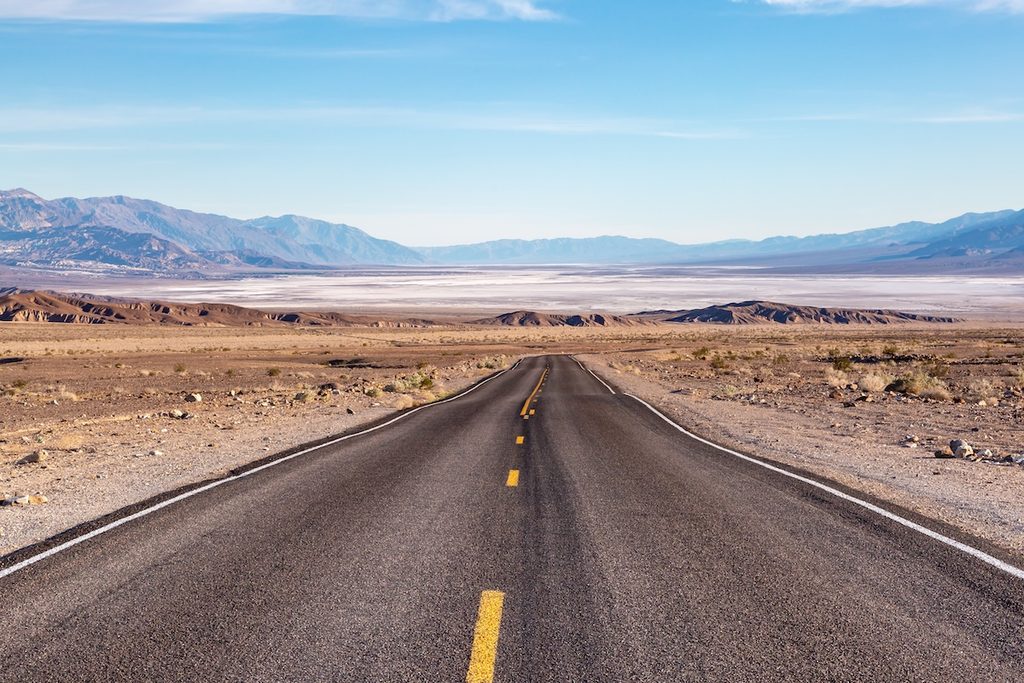
Today California changes planets.
Leave Joshua Tree and work north towards Death Valley.
The landscape becomes increasingly enormous and increasingly uninterested in human scale until eventually you arrive in a national park containing the lowest point in North America and some of the hottest temperatures measured anywhere on Earth.
Death Valley is not merely a desert.
It is what happens when a desert acquires ambition.
Depending on your arrival time and the weather, use the later afternoon for one or two easily accessible highlights rather than trying to conquer the park immediately.
Zabriskie Point is an excellent introduction.
Badwater Basin, at 282 feet below sea level, supplies the geographical superlative.
Dante’s View supplies the perspective.
And the spaces between them supply much of the point.
Death Valley does not require a reservation to enter. A private-vehicle entrance pass currently costs $30 and is valid for seven days. The park is cashless for its own entrance and campground fee collection.
But conditions matter here more than itinerary.
Road conditions can change after flooding and other weather events, and some routes were still affected by earlier flood damage in 2026. Check the park’s current road-status information immediately before travelling.
Do that.
A line on Google Maps is not evidence that a desert road currently exists in the condition you would prefer.
Day 4: Death Valley to Three Rivers
Sleep: Three Rivers
This is the day you earn the rest of the itinerary.
Death Valley and Sequoia National Park look reasonably adjacent when California is displayed on a laptop.
The Sierra Nevada has opinions about this.
There is no convenient road straight across the mountains between them, so reaching the western entrance to Sequoia requires a substantial journey around the southern Sierra.
Treat this as the big transfer day.
Allow roughly 6½ hours of pure driving from the Death Valley area to Three Rivers, and potentially considerably longer once fuel, food, traffic, road conditions and stops are included.
Leave early.
Don’t plan a heroic Death Valley hike first.
Don’t assume a road that looks shorter is necessarily faster.
And don’t arrive at the Sequoia foothills furious because California failed to arrange its mountain range around your holiday.
The drive is part of the lesson.
In the morning you’re travelling through one of the driest landscapes in America.
By evening you’re approaching forests containing the world’s largest trees by volume.
There aren’t many road trips where the scenery can change the subject that completely in one day.
Base yourself around Three Rivers, near Sequoia’s southern entrance, and save the giants for tomorrow.
Day 5: Sequoia National Park
Sleep: Three Rivers or inside/near the park
There are large trees.
There are very large trees.
And then there is the General Sherman Tree.
The point of Sequoia National Park isn’t merely ticking off the world’s largest living tree by volume, however. It is spending enough time in the Giant Forest for your sense of scale to stop working properly.
Drive the Generals Highway into the high country and give the park most of the day.
The road itself deserves respect. The climb towards Giant Forest is steep, narrow and extremely winding, and the National Park Service has a vehicle-length advisory for vehicles 22 feet and longer between Potwisha Campground and Giant Forest Museum.
There are also no gas stations inside Sequoia and Kings Canyon national parks, so fill up before relying on optimism.
No reservation is currently required simply to enter Sequoia and Kings Canyon. Road access, however, can change with snow, storms and construction.
This is another place where less is more.
Walk among the trees.
Spend some time not photographing them.
Then photograph them anyway, because nobody is going to believe you when you explain the size.
Day 6: Sequoia to Yosemite
Sleep: Yosemite Valley, El Portal, Yosemite West or nearby
Today takes you north towards Yosemite.
The distance is manageable.
The temptation is therefore to turn the journey into an elaborate sightseeing exercise.
Resist.
Yosemite deserves the time.
If giant sequoias are a particular interest, the Mariposa Grove near Yosemite’s South Entrance can make a logical stop.
Otherwise, after spending yesterday among the largest trees on Earth, you are entirely entitled to say, “I think I’ve seen a tree,” and continue towards Yosemite Valley.
That is probably what I would do.
In 2026, Mariposa Grove shuttle service runs seasonally and is weather-dependent. Ordinary private vehicles generally cannot drive the Grove Road, and when the shuttle is not operating, reaching the grove involves a roughly two-mile walk each way.
So don’t treat it as a five-minute roadside attraction.
Then continue into Yosemite Valley.
There are certain famous places whose reputation creates a problem.
You’ve seen too many photographs.
Yosemite has been photographed so often that Half Dome and El Capitan can feel familiar before you’ve ever visited.
Then you drive into the valley.
The photographs lose.
Day 7: Yosemite National Park
Sleep: Yosemite area
Give Yosemite a complete day.
Not three hours.
Not a lunchtime lap of the valley followed by a dash towards San Francisco.
A day.
In 2026, Yosemite does not require a vehicle reservation for general park entry, although entrance fees still apply and accommodation and camping should be reserved well ahead.
What you do depends on season, fitness and current conditions.
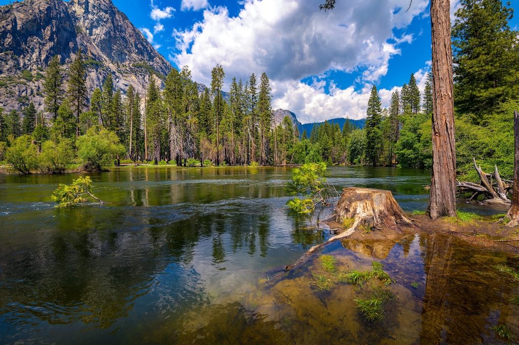
Yosemite Valley gives you El Capitan, Half Dome, meadows, waterfalls and many of the park’s most famous views.
Glacier Point, when accessible, changes the perspective entirely.
Tioga Road, when open, gives access to Yosemite’s high country — but adding a serious Tioga excursion to a one-full-day Yosemite visit can turn a magnificent day into an exercise in moving the car.
Don’t feel compelled to see everything.
Yosemite contains nearly 1,200 square miles.
You will not complete it before dinner.
The objective is not to finish Yosemite.
It is to understand why you need to come back.
Day 8: Yosemite to San Francisco
Sleep: San Francisco
Leave the Sierra and head west.
The mountains flatten.
Agricultural California takes over.
Eventually traffic begins behaving like traffic again and San Francisco announces itself.
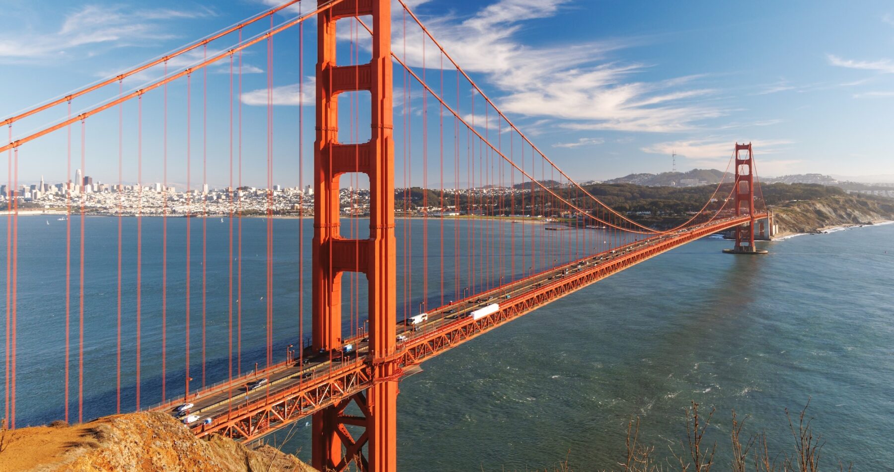
If you’ve never driven into the city before, this is one of the trip’s great transitions: after deserts, forests and granite cliffs, suddenly there are steep streets, Victorian houses, cable cars and a bridge you’ve been seeing in movies since approximately birth.
Once you’ve checked in, consider parking the car.
San Francisco is one of the few places on this road trip where your vehicle can quickly change from liberator to expensive metal problem.
Spend the evening on foot.
California has given you plenty of road.
You are allowed to walk now.
Day 9: San Francisco
Sleep: San Francisco
No major driving today.
That’s deliberate.
See the Golden Gate Bridge.
Explore neighbourhoods.
Ride a cable car if you’ve never done it.
Walk the waterfront.
Eat something excellent.
Stand on a hill and wonder why anybody thought building streets at that angle was a sensible civic decision.
If Alcatraz is important to you, book ahead rather than treating it as something you’ll casually arrange over breakfast.
And don’t leave luggage or visible valuables in your rental vehicle.
More broadly, Day 9 performs an important road-trip function.
It stops the trip becoming work.
There is a strange phenomenon that occurs on ambitious driving holidays in which the traveller begins evaluating a day by how many scheduled attractions have been successfully processed.
San Francisco is your intervention.
Have lunch.
Waste some time.
You’re on holiday.
Day 10: San Francisco to Monterey and Carmel
Sleep: Monterey or Carmel
Now the trip turns towards the Pacific.
You could blast south on the fastest road.
That would rather miss the next four days.
Head towards the Monterey Peninsula and give yourself time for the coast.
Monterey and neighbouring Carmel make an excellent staging point before Big Sur. Depending on your interests, the day can include the Monterey waterfront, Cannery Row, Carmel’s compact centre, beaches and the peninsula scenery.
This is also the moment to check Highway 1 conditions again.
Not last month.
Not when you booked the flights.
Now.
California’s coastal highway is vulnerable to landslides, fires, storms and emergency closures, particularly around Big Sur.
The need to check isn’t theoretical. In September 2026, wildfire operations temporarily closed sections of Highway 1 in Big Sur, with Caltrans directing through travellers to US 101.
A California coastal road trip needs a Plan B.
Fortunately, California has built other roads.
Day 11: Big Sur to San Luis Obispo
Sleep: San Luis Obispo, Morro Bay or Cambria
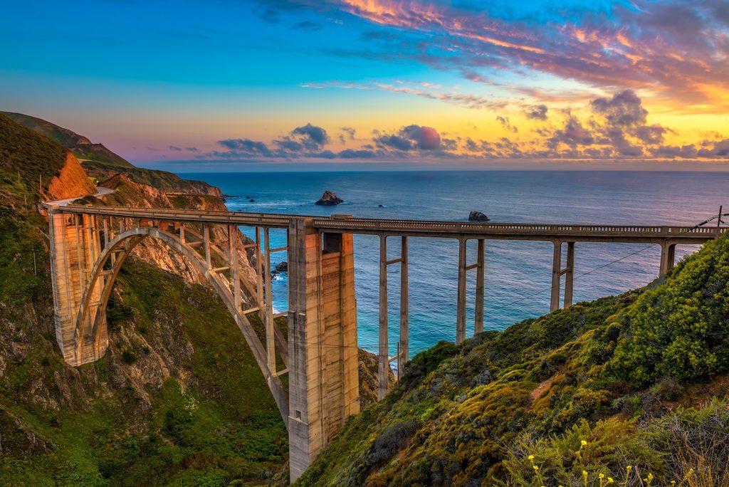
If Highway 1 is fully open through Big Sur, this is one of the great road-trip days in America.
Don’t ruin it by scheduling twelve other things.
Leave Monterey or Carmel and head south.
Driving this direction puts the ocean on your side of the road, which is useful both for views and many coastal pullouts.
Bixby Creek Bridge.
Big Sur.
Cliffs.
Redwoods.
Ocean.
Then the long transition south towards San Simeon, Cambria, Morro Bay and San Luis Obispo.
This is not a road where mileage tells you much.
A hundred miles of spectacular coast can consume most of a day because you’ll keep stopping, traffic can be slow and the entire purpose of being there is to avoid behaving as though you’re late for a meeting.
Check Caltrans before departure.
If Highway 1 is closed somewhere that prevents through travel, do not attempt to improvise around barriers on minor mountain roads. Use the official detour, which commonly means returning to or using US 101 depending on the closure.
The coast is the attraction.
Getting stranded while arguing with your navigation app is not.
Day 12: San Luis Obispo to Santa Barbara
Sleep: Santa Barbara
After Big Sur, today is intentionally gentler.
San Luis Obispo gives you a choice.
Spend the morning around town.
Take in Morro Bay if you stayed there.
Explore the coast.
Then continue south towards Santa Barbara.
This stretch doesn’t need to compete with Big Sur. That’s precisely why it works.
California road trips improve enormously when every day isn’t required to become The Greatest Day Of The Holiday.
Santa Barbara provides an almost absurdly pleasant change of pace: mountains behind you, Pacific in front, Spanish Colonial Revival architecture, palm trees and a waterfront that appears to have negotiated favourable weather terms.
Walk.
Eat.
Have a drink.
The car has done enough.
Day 13: Santa Barbara to Los Angeles
Sleep: Los Angeles
The obvious temptation is to regard today as the trip home.
Don’t.
The Southern California coast still has work to do.
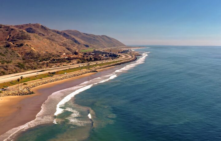
Take the coastal route through Ventura and, conditions permitting, continue through Malibu towards Santa Monica rather than automatically disappearing inland onto the fastest freeway.
This is where the loop closes beautifully.
Nearly two weeks ago you left Los Angeles heading for the desert.
Since then you’ve been below sea level, among giant sequoias, beneath Yosemite granite, through San Francisco and down one of the world’s great coast roads.
Now Los Angeles reappears beside the Pacific.
Visit California itself builds its Highway 1 route north from Los Angeles through Santa Monica, Malibu and Ventura before the highway joins US 101 — the same coastline you’re now following in reverse.
By this stage, you may have developed a useful Californian skill.
You no longer ask how many miles away something is.
You ask how bad the traffic is.
Progress.
Day 14: Los Angeles
Finish: Los Angeles
This is the buffer day.
Do not underestimate the value of a buffer day.
Use it for whatever Los Angeles you skipped at the beginning: Griffith Observatory, Santa Monica, museums, neighbourhoods, beaches, restaurants or simply sitting somewhere while somebody else deals with the traffic.
If you’re flying home tonight, you’re already in the correct city.
If something earlier in the trip went wrong — weather, road closure, a Yosemite day you refused to end — Day 14 also gives the itinerary somewhere to absorb the disruption.
That is much better than designing a 14-day road trip containing exactly 14 days of non-negotiable logistics.
California is not known for consulting your spreadsheet.
What about Lake Tahoe?
Excellent.
Not on this trip.
Lake Tahoe is one of California’s great destinations, but adding it to a two-week loop already containing Joshua Tree, Death Valley, Sequoia, Yosemite, San Francisco and Big Sur creates precisely the problem we’re trying to avoid.
You start visiting places because they’re famous rather than because you have time to experience them.
Give Tahoe another trip — perhaps paired with the Eastern Sierra.
The same applies to Napa Valley.
And Kings Canyon.
And San Diego.
And Lassen.
And Redwood National and State Parks.
And suddenly we have discovered why California needs more than one holiday.
Should you include Death Valley?
This depends almost entirely on when you’re travelling.
In cooler weather, absolutely.
Death Valley supplies one of the great contrasts of the trip and makes the transition from Southern California desert to the Sierra much more dramatic.
In extreme summer heat?
I’d leave it out.
The National Park Service warns that summer highs can reach around 130°F and recommends against hiking at lower elevations during hot conditions. Visitors touring in extreme heat should stay on paved roads, remain close to an air-conditioned vehicle and carry substantial water.
That isn’t the sort of warning to treat as a challenge.
If you’re travelling in July or August, use the saved day somewhere you’ll enjoy being outside.
Yosemite would like a word.
What if Highway 1 is closed?
This needs to be built into any California itinerary, because Highway 1 is a road attached to cliffs beside an ocean.
Occasionally the cliffs object.
Check Caltrans QuickMap immediately before the coastal portion of the trip.
If Big Sur is open to through traffic, follow the itinerary as written.
If a closure divides the route, don’t assume you can reach a famous viewpoint from one side and then continue through. Depending on the location of the closure, Big Sur may effectively become an out-and-back journey from the north or south.
Use US 101 for the through journey when instructed by Caltrans.
This is important because an itinerary written when Highway 1 is open can become nonsense after one landslide.
The Pacific Ocean is beautiful.
It is not especially interested in maintaining transport infrastructure.
Do you need reservations for the national parks?
Not one universal reservation.
In 2026, Yosemite does not require a timed vehicle reservation simply to enter. Joshua Tree likewise has no general entrance-reservation system, and Sequoia and Kings Canyon do not require reservations simply for entry.
That does not mean you can treat the parks casually.
Lodging and popular campgrounds can book far ahead. Particular activities may require permits or reservations. Half Dome, for example, requires a permit when the cables are up.
Rules also change.
So use this article to design the journey, then check each park’s official National Park Service page when you book and again shortly before travelling.
Because this itinerary visits several national parks, it is also worth comparing the current price of an America the Beautiful annual pass with paying individual entrance fees. The pricing and rules differ for US residents and international visitors in 2026.
Road trips reward spontaneity.
Sleeping in Yosemite in peak season does not.
International visitors: check the 2026 park fees
There is another 2026 wrinkle if you live outside the United States.
Non-US residents aged 16 and over are charged an additional $100 per person at 11 major national parks.
Two of them are on this itinerary: Sequoia & Kings Canyon and Yosemite.
Joshua Tree and Death Valley are not on the list.
That can substantially change the economics of visiting several national parks.
In 2026, a non-resident America the Beautiful annual pass costs $250, and a valid pass can cover the passholder and passengers travelling with them in a private vehicle, including applicable nonresident fees.
US residents continue to have different pass pricing.
If you’re travelling from overseas and visiting several major national parks, compare the pass with paying individual entrance and nonresident fees before setting out.
And check the current National Park Service rules before buying.
Park fees are precisely the sort of thing you don’t want to discover at the entrance booth.
How much driving is too much?
There is a very easy way to destroy a California road trip.
Calculate every drive using the number Google Maps displays at 10.43pm on a Tuesday.
Then construct your holiday as though nothing will ever interfere with it.
California contains Los Angeles traffic, Bay Area traffic, mountain roads, roadworks, snow, wildfires, scenic pullouts and other people who have also decided to visit Yosemite.
A nominal four-hour drive is not necessarily four hours of your holiday.
It may be six.
And that’s fine if you haven’t promised yourself lunch, a hike, sunset and three museums at the other end.
The Death Valley-to-Sequoia transfer is deliberately the ugly day in this itinerary.
Every good road trip is allowed one.
The mistake is having seven.
What car do you need?
For the route described here, under normal open-road conditions, you do not need an SUV simply because California contains mountains.
A normal rental car is usually the sensible choice.
It will use less fuel, be easier to park in San Francisco and Los Angeles, and remain perfectly capable of travelling the paved roads on this itinerary.
What matters more is season.
Snow and chain controls can affect Sierra roads. Death Valley can experience flash flooding. Big Sur can close after landslides, fires or storms.
Renting something enormous does not repeal weather.
If travelling in winter or the edges of the Sierra snow season, investigate rental-company policies around tyre chains before collecting the car. Don’t discover the contractual fine print while standing beside a chain-control sign.
Don’t underestimate fuel
California has plenty of gas stations.
California also has places without them.
Joshua Tree has none inside the park. Sequoia and Kings Canyon have none inside the national parks. Death Valley is enormous and services are widely separated.
Our rule is simple:
In remote country, half a tank is the new empty.
This is not because you’ll necessarily run out.
It is because spending an afternoon calculating whether 63 miles of indicated range can survive a mountain pass is an inferior form of sightseeing.
Electric vehicles require even more deliberate planning, particularly around national parks and remote desert sections. Don’t plan charging from memory or assumption; map the actual compatible chargers for your car and route before leaving each major stop.
The California mistake
The biggest mistake people make on a California road trip isn’t taking the wrong highway.
It’s treating the state like a checklist.
Hollywood.
Joshua Tree.
Death Valley.
General Sherman.
Yosemite.
Golden Gate Bridge.
Big Sur.
Done.
But California isn’t impressive because it contains a collection of famous attractions.
It’s impressive because of what happens between them.
It’s leaving Los Angeles traffic and watching the suburbs dissolve into desert.
It’s waking below sea level and ending the next day beneath sequoias.
It’s the first glimpse into Yosemite Valley.
It’s emerging from the Sierra into agricultural country and eventually seeing San Francisco.
It’s turning south from Monterey and realising that, for the next hundred miles, the road itself is the attraction.
And it’s returning to Los Angeles two weeks later by the Pacific, having made a loop through deserts, mountains, forests and cities that would be major destinations if they were scattered across five different states.
Fourteen days isn’t enough to see California.
That’s the good news.
It means you don’t have to try.
Take the loop.
Leave things out.
Stop when the road gives you a reason.
California will provide plenty.