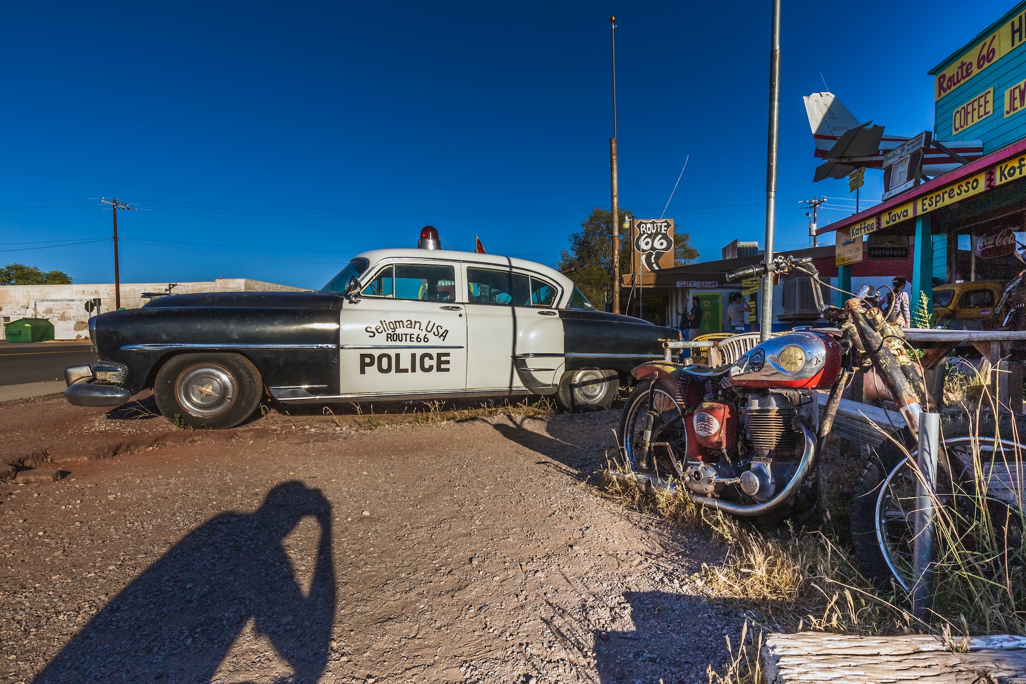
Eight states. Roughly 2,400 miles. One enormous blue whale. Several giant fibreglass men. A disturbing number of excellent neon signs. And the Pacific Ocean waiting at the other end.
There are faster ways to drive from Chicago to Los Angeles.
That is rather the point.
Interstate highways were designed to remove inconvenience from travel. Route 66 is worth driving because it puts much of it back.
It wanders through towns you would otherwise bypass, changes names without warning, occasionally disappears altogether and presents perfectly serious adults with questions such as: Should we stop to photograph that enormous concrete whale?
The answer, incidentally, is yes.
Route 66 crosses eight states on its journey from Chicago through Illinois, Missouri, a tiny corner of Kansas, Oklahoma, Texas, New Mexico and Arizona before finally reaching California and the Pacific at Santa Monica.
It is not America’s oldest highway. It wasn’t its longest. It doesn’t even exist anymore as an official US highway.
And yet no other road comes close.
Route 66 became shorthand for the American road trip itself: migration and motels, diners and desert, optimism and reinvention, neon signs promising VACANCY to people who had already driven too far to argue about the room.
In 2026, exactly a century after Route 66 was designated, the Mother Road remains one of the great journeys in America.
Route 66 at a glance
Distance: Roughly 2,400 miles / 3,860 km, depending on the historic alignment
States: 8
Best trip length: 14–21 days
Minimum we’d recommend: 10 days
Best seasons: Late spring and early autumn
Direction: Chicago → Santa Monica for the classic westward journey
Navigation: A dedicated Route 66 map + offline maps + GPS
Don’t assume: Every historic alignment is paved, open or suitable for a rental car
But there is something you should know before setting off.
First: there isn’t actually one Route 66
This is where planning gets interesting.
Route 66 was designated in 1926, but it wasn’t constructed from scratch. Existing roads were stitched together into a new highway running from Chicago to Los Angeles. Over the following six decades sections were straightened, widened, resurfaced and rerouted.
Then the Interstate Highway System arrived.
Route 66 was progressively bypassed by I-55, I-44, I-40, I-15 and I-10 until the old highway was officially decommissioned in 1985.
So you cannot enter “Route 66” into the navigation system and blindly follow the blue line for 2,400 miles.
There are multiple historic alignments. Some are ordinary streets. Some are state highways. Some became frontage roads beside the Interstate. Some are beautifully preserved pieces of old pavement. Others are gravel, broken, abandoned, inaccessible or simply gone.
That sounds inconvenient.
It is also what makes the journey interesting.
You aren’t simply following a highway. You’re reconstructing one.
The National Park Service maintains an interactive Route 66 map, while dedicated Route 66 maps distinguish between the different historic alignments. Choose a sensible mostly paved alignment before departure and treat Google Maps as an assistant rather than the expedition leader.
And don’t become so committed to historical authenticity that you drive your rental Mustang down something resembling a cattle track because an automobile association put a number on it in 1929.
The original motorists had enough mechanical problems already.
How long do you need to drive Route 66?
Technically?
You could cover the distance in four or five punishing days.
Don’t.
A sensible Route 66 trip needs at least 10 days. Two weeks is much better. Three weeks allows you to stop wondering whether every interesting thing is “worth the time” and actually enjoy yourself.
For a first trip, 14 days is the sweet spot.
That gives you enough time to drive the historic sections, explore the major towns, photograph the roadside oddities and spend evenings somewhere other than a steering wheel.
A good two-week
itinerary looks
something like this
Day 1: Chicago to Springfield, Illinois
Day 2: Springfield to St Louis
Day 3: St Louis to Springfield, Missouri
Day 4: Springfield to Tulsa
Day 5: Tulsa to Oklahoma City
Day 6: Oklahoma City to Amarillo
Day 7: Amarillo to Santa Fe via the original 1926–37 alignment
Day 8: Santa Fe to Albuquerque
Day 9: Albuquerque to Gallup
Day 10: Gallup to Flagstaff
Day 11: Flagstaff to Kingman
Day 12: Kingman to Needles via Oatman
Day 13: Needles to Barstow
Day 14: Barstow to Santa Monica
Add extra nights in Chicago and Los Angeles if this is part of a larger US trip.
And if you’ve flown halfway around the world to do it, adding another three or four days is money well spent.
Because nobody gets home from Route 66 wishing they’d spent more time on the Interstate.
Illinois: where the road begins
Chicago → Joliet → Pontiac → Springfield → St Louis
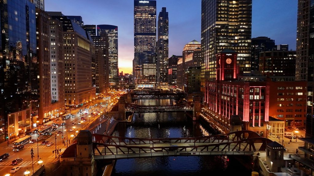
Route 66 begins amid skyscrapers.
Route 66 traditionally begins in downtown Chicago. Most modern travellers start at the Historic Route 66 Begin sign on East Adams Street near Michigan Avenue, although the highway’s original 1926 terminus was nearby at Jackson Boulevard and Michigan Avenue.
For the 2026 centennial, Chicago has added another ceremonial starting point at Navy Pier, creating a neat pier-to-pier bookend with Santa Monica.
Whichever starting photograph you choose, take it. You will want the matching one beside the Pacific in two weeks’ time.
Then leave Chicago behind.
This first transition is one of the pleasures of driving west. America’s third-largest city gradually gives way to suburbs, then smaller cities, cornfields and towns whose relationship with Route 66 is considerably more enthusiastic than Chicago’s.
Illinois has embraced its stretch of the Mother Road particularly well, with about 300 miles of Route 66 experiences promoted through the state.
In Wilmington, the Gemini Giant provides an early introduction to one of the road’s defining art forms: large things beside roads.
The roughly 30-foot fibreglass astronaut belongs to the family of “Muffler Men” once used as advertising figures across America. Route 66 preserved several of these gloriously unsubtle monuments to the theory that customers are more likely to stop if your business has a gigantic man standing outside.
Pontiac is one of the best early stops. Its Route 66 museum, murals and preserved downtown make it an excellent introduction to the culture surrounding the highway rather than merely its pavement.
Continue south through Bloomington-Normal and Atlanta towards Springfield.
Here Route 66 collides with another enormous American story: Abraham Lincoln.
Lincoln lived in Springfield for 17 years before becoming president. His home, tomb and the Abraham Lincoln Presidential Library and Museum make the city worth considerably more than a fuel stop.
Then keep moving south.
The landscape flattens. Old alignments appear beside newer roads. Vintage filling stations and signs start making more sense.
By the time you reach the Mississippi River, Route 66 has begun working on you.
You are now stopping to photograph petrol stations.
This is normal.
⸻
Missouri: neon, caves and the Ozarks
St Louis → Cuba → Rolla → Lebanon → Springfield → Joplin
Crossing the Mississippi marks the first great threshold of the journey.
St Louis is worth a proper stop, Route 66 or otherwise. The Gateway Arch rises 630 feet above the riverfront and is an irresistible symbol for a trip heading west.
Then Route 66 begins climbing into the Missouri Ozarks.
The road here twists and rolls more than the Illinois section, and the towns contain some wonderful surviving roadside architecture.
Cuba bills itself as Route 66 Mural City. Lebanon has the famous Munger Moss Motel sign. Carthage has Boots Court, a restored motor court dating from the 1940s. Missouri tourism describes its Route 66 corridor as 317 miles long, running through communities including St Louis, Cuba, Rolla, Lebanon, Springfield, Carthage and Joplin.
Then there are Meramec Caverns.
Caves existed before advertising, obviously, but Route 66 entrepreneurs occasionally behaved as though nobody would have noticed them without several hundred roadside signs.
Meramec became one of the classic attractions of the road-trip era, promoted relentlessly to passing motorists.
This was an important part of Route 66 culture.
The highway created a captive audience travelling at comparatively low speeds. Businesses competed for attention with increasingly spectacular signs, architecture and roadside gimmicks.
A petrol station could look like a cottage.
A restaurant could be shaped like something ridiculous.
A reptile collection could become a tourist attraction simply by putting LIVE RATTLESNAKES on enough billboards.
Modern digital advertising may be more sophisticated.
It is rarely as entertaining.
Kansas: all 13 miles of it
Galena → Riverton → Baxter Springs
Do not blink.
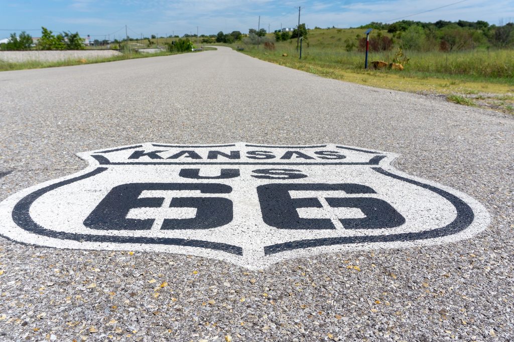
Route 66 clips the southeastern corner of Kansas for only about 13 miles, making this easily the shortest state section of the journey.
That doesn’t mean you should skip it.
Galena is an old mining town with Route 66 attractions and a streetscape that feels far removed from Chicago despite being only a few days down the road.
Nearby is the historic Rainbow Bridge, and then comes Baxter Springs before Route 66 crosses into Oklahoma.
Kansas is short enough that treating it as something to “get through” would be missing the joke.
You’ve driven thousands of miles to follow an obsolete highway.
You can spare half an hour for Kansas.
⸻
Oklahoma: the Mother Road’s heartland
Miami → Tulsa → Chandler → Oklahoma City → Clinton → Elk City
If Route 66 has a spiritual home, Oklahoma has a persuasive claim.
The state contains more than 400 drivable miles of Route 66 — the longest drivable stretch in the country — and Oklahoma’s Cyrus Avery was one of the central figures in creating and promoting the highway.
This is where the road trip becomes wonderfully strange.
Near Miami, adventurous Route 66 completists can find the famous Ribbon Road, an extraordinarily narrow early roadway only nine feet wide.
Then comes one of Route 66’s great masterpieces.
The Blue Whale of Catoosa.
It is exactly what it sounds like.
A giant smiling blue whale sits beside a pond, created in the early 1970s by Hugh Davis as an anniversary gift for his wife. It subsequently became a swimming attraction and then, after restoration, one of the Mother Road’s most beloved roadside oddities.
There is no intellectually respectable reason to love the Blue Whale.
You will love it anyway.
Tulsa deserves time, particularly for its Art Deco architecture and its deep association with Cyrus Avery.
Then the road rolls through places including Arcadia — home of the Round Barn and the enormous soda bottle outside POPS — Chandler and Oklahoma City.
West of Oklahoma City, the highway increasingly begins to feel like the West.
Clinton’s Oklahoma Route 66 Museum tells the highway’s story decade by decade, while Elk City’s National Route 66 & Transportation Museum provides another substantial stop before the landscape opens towards Texas.
Somewhere out here, the road-trip clichés stop feeling like clichés.
Big sky.
Straight road.
Radio on.
Town disappearing in the rear-view mirror.
Another one appearing on the horizon.
There is a reason people kept writing songs about this.
Texas: steaks, Cadillacs and enormous horizons
Shamrock → McLean → Amarillo → Adrian → Glenrio
Route 66 crosses the Texas Panhandle rather than the Texas of cowboy-movie imagination.
The land is enormous, agricultural and spectacularly horizontal.
Shamrock provides one of the road’s great architectural survivors: the restored Tower Station and U-Drop Inn, an Art Deco filling station and restaurant built in 1936.
Then comes Amarillo.
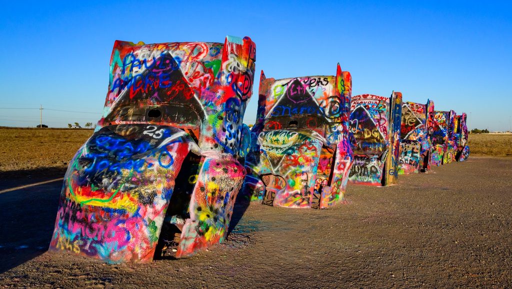
And outside Amarillo, ten Cadillacs are buried nose-first in a field.
Because of course they are.
Cadillac Ranch was created in 1974 and has since become an evolving public artwork, its cars repeatedly covered with layers of spray paint by visitors.
It is absurd, photogenic and unmistakably Route 66.
Amarillo also offers another celebrated form of roadside theatre: the 72-ounce steak challenge at the Big Texan Steak Ranch.
You do not need to attempt it.
Indeed, approximately 2.04 kilograms of beef seems an unnecessarily aggressive way to establish your credentials as a traveller.
West of Amarillo comes Adrian and the MidPoint Café.
The attraction here is mathematical.
Adrian sits around the halfway point between Chicago and Los Angeles on the traditional Route 66 journey.
Take the photograph.
Eat some pie.
Contemplate the fact that after several states and an alarming amount of diner food, you are only halfway there.
⸻
New Mexico: where Route 66 gets complicated
Tucumcari → Santa Rosa → Santa Fe → Albuquerque → Grants → Gallup
New Mexico demonstrates why Route 66 needs a map.
The original 1926 alignment made an enormous northward loop through Santa Fe before descending to Albuquerque. In 1937 the highway was substantially realigned, creating a much more direct east-west route.
Both are Route 66.
For a first journey with enough time, take the old road through Santa Fe.
It adds distance.
It also adds Santa Fe.
This is not a difficult trade-off.
Before that comes Tucumcari, where restored and surviving neon signs turn the town into one of the best places on the entire route after dark.
This is where you begin to understand what nighttime driving once looked like.
Neon was the internet advertising of mid-century America: glowing arrows, cowboys, motel names and VACANCY signs competing for motorists who might decide where to sleep based on whichever sign looked most convincing at 40mph.
Then there is Santa Fe itself, one of America’s oldest and most distinctive cities, with adobe architecture, galleries, Native American and Hispanic cultural influences and food that will make another hamburger feel like a personal failure.
From Santa Fe, the historic road drops towards Albuquerque.
Central Avenue carries Route 66 through the city, accompanied by surviving neon and classic motels.
Continue west through Grants towards Gallup.
New Mexico is also where a simplistic celebration of Route 66 needs some perspective.
The highway crosses or connects with numerous Tribal lands and communities. Native American culture along the road is not roadside decoration or an historical theme. These are living communities.
Buy Native art from reputable Native artists and businesses. Follow photography restrictions. Respect sites and ceremonies. Treat Tribal land as somebody’s home, because it is.
The Mother Road is an American story.
That means it contains more than one America.
⸻
Arizona: perhaps the greatest Route 66 state of all
Holbrook → Winslow → Flagstaff → Seligman → Kingman → Oatman
If you have been waiting for the cinematic Route 66 — red rock, desert, trading posts, endless sky and long stretches of old pavement — Arizona delivers it.
Almost immediately there is Petrified Forest National Park, the only National Park Service site containing a segment of the historic Route 66 alignment.
The old pavement itself is largely gone within the park, but telephone poles trace its former course through the landscape.
That is strangely moving.
For most of this journey Route 66 survives as a road.
Here you can see what happens when a road becomes archaeology.
Next comes Holbrook and its famous Wigwam Motel, where guests sleep in concrete teepee-shaped rooms with vintage cars parked outside.
Then Winslow.
Yes, that Winslow.
The Eagles turned an otherwise modest Arizona town into a pilgrimage site with “Take It Easy”, and Winslow has enthusiastically accepted its fate. There is now a Standin’ on the Corner Park.
You will stop.
Everybody stops.
Flagstaff provides pine forest, altitude and an excellent base if you want to make a major detour to the Grand Canyon.
And yes, you should seriously consider it.
The South Rim isn’t directly on Route 66, but coming this close to one of the planet’s most extraordinary landscapes and refusing to deviate from the sacred highway would be an impressive commitment to administrative accuracy.
Then comes Seligman.
When Interstate 40 bypassed the town in 1978, businesses suffered badly. Local barber Angel Delgadillo became a leader of the movement to preserve and promote the old highway. Arizona subsequently designated the road from Seligman to Kingman as Historic Route 66.
Today Seligman is wonderfully, unapologetically obsessed with the Mother Road.
More importantly, it marks the beginning of one of the journey’s best surviving stretches.
From Seligman, old Route 66 runs west through Peach Springs and Hackberry towards Kingman, with the Interstate finally somewhere else.
This is the bit you’ve imagined.
Then things get even better.
⸻
Oatman: Route 66 goes over the mountain
Kingman → Sitgreaves Pass → Oatman → Topock
West of Kingman, take the old alignment through the Black Mountains towards Oatman.
Do not rush it.
And if you are driving a huge RV, towing something enormous, terrified of heights or simply dislike narrow winding mountain roads, research this section carefully before committing to it.
For everybody else, this is one of the great drives of Route 66.
The road climbs through the Black Mountains to Sitgreaves Pass before twisting down towards Oatman.
The old mining town has wooden shopfronts, staged gunfights and wild burros wandering through the street with the self-confidence of animals that have correctly identified themselves as the principal tourist attraction.
They descend from animals used by miners during the region’s mining era.
Today they wander around town inspecting tourists.
The burros have won.
From Oatman the road descends towards the Colorado River.
Cross it.
You are in California.
⸻
California: the long road to the Pacific
Needles → Amboy → Barstow → San Bernardino → Pasadena → Los Angeles → Santa Monica
The California border feels like the beginning of the end.
It isn’t.
You still have hundreds of miles to go.
First comes Needles, on the Colorado River.
Then Route 66 enters the Mojave.
This is one of the most atmospheric stretches of the entire journey and one where preparation matters. Temperatures can be extreme, services can be widely separated and historic alignments should never be assumed to have fuel, water or mobile reception just because they appear on a map.
Fill the tank.
Carry water.
Then enjoy the emptiness.
At Amboy, the enormous Googie-style sign of Roy’s Motel and Café rises from the desert.
Roy’s began as a service station in 1938 and expanded into a motel, café and repair operation as Route 66 traffic increased.
Then the Interstate arrived.
Amboy declined until it became almost a ghost town.
That makes Roy’s one of the best places on Route 66 to understand what the highway did — and what its disappearance did.
A road can create a town.
Another road can kill it.
Continue towards Barstow, then San Bernardino and finally into the vast urban organism of Greater Los Angeles.
The desert disappears.
Traffic multiplies.
The road that has spent days connecting tiny towns becomes city streets again.
Pasadena.
Los Angeles.
West Hollywood.
Beverly Hills.
Santa Monica.
And eventually:
the ocean.
⸻
So where does Route 66 actually end?
This is unnecessarily complicated, which makes it a perfect Route 66 question.
The original 1926 highway terminated in downtown Los Angeles.
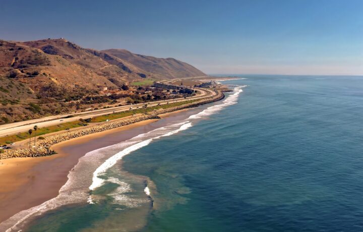
In 1936, Route 66 was extended west to Santa Monica.
The official Santa Monica terminus during Route 66’s classic era was at the intersection of Lincoln Boulevard and Olympic Boulevard.
But that’s not where everybody takes the photograph.
The famous “End of the Trail” sign stands at Santa Monica Pier, overlooking the Pacific.
It is a symbolic endpoint rather than the historic official highway terminus.
You should go there anyway.
After roughly 2,400 miles, eight states, innumerable diners, several hundred photographs and at least one inexplicably large roadside animal, pedantry can wait.
Park the car.
Walk onto the pier.
Take the photograph.
Look west.
There isn’t any more America.
⸻
The Route 66 stops we’d refuse to skip
If time forces you to choose, these are the experiences that best tell the story of the road rather than simply filling an itinerary:
Chicago’s Route 66 start sign — because every ridiculous undertaking deserves a starting photograph.
Pontiac, Illinois — an excellent introduction to Route 66 history and preservation.
St Louis and the Mississippi — the symbolic gateway west.
A restored motor court — stay in at least one rather than spending every night in generic chain hotels.
The Blue Whale of Catoosa — because explaining why you didn’t stop will be harder than stopping.
Oklahoma’s old road alignments — where Route 66 feels like a road rather than a brand.
Cadillac Ranch — roadside America distilled into ten half-buried cars.
Tucumcari after dark — see the neon illuminated.
The Santa Fe alignment — if your schedule allows it.
Petrified Forest National Park — landscape, history and the ghost of the old road.
Seligman to Kingman — one of the essential driving stretches.
Sitgreaves Pass and Oatman — the most dramatic old-road driving experience.
Roy’s at Amboy — the desert Route 66 photograph.
Santa Monica Pier — historically imperfect, emotionally perfect.
⸻
When is the best time to drive Route 66?
There is no perfect month because Route 66 crosses an absurd amount of geography.
Chicago can be freezing while the Mojave is pleasant. In summer, the Midwest can be humid while the desert becomes brutally hot. At higher elevations around Flagstaff, winter weather can be serious.
For most travellers, late spring and early autumn offer the best compromise.
May into early June and September into early October generally avoid the most extreme desert heat while giving you reasonable conditions across much of the route.
Summer is absolutely possible, but take the western desert seriously. Needles and the Mojave are not places to discover that your interpretation of “plenty of water” was two half-empty bottles rolling around under the passenger seat.
Winter requires another kind of preparation, particularly in Illinois, Missouri, New Mexico and the higher country of Arizona.
Check forecasts and road conditions as you travel rather than relying on seasonal averages.
Route 66 is 2,400 miles long.
The weather at the other end does not care what it was doing when you started.
⸻
What car should you use?
The fantasy answer is a 1965 Ford Mustang convertible.
The sensible answer is something comfortable, reliable and economical with good air-conditioning.
You will spend dozens of hours in it.
Prioritise:
* comfortable seats;
* enough luggage space;
* cruise control;
* good visibility;
* a clear understanding of what happens if you get a puncture;
* unlimited or generous rental mileage; and
* roadside assistance.
A convertible sounds magnificent until the desert sun has spent three hours attempting to cook your forehead.
Classic cars are wonderful if maintaining a classic car is part of the adventure you actually want.
For everybody else, rent the boring reliable thing and photograph it beside the interesting old cars.
⸻
Can you drive Route 66 in an electric car?
Increasingly, yes.
Major towns and Interstate corridors provide substantial charging infrastructure, and even Illinois tourism now publishes a Route 66 itinerary specifically for electric vehicles.
But Route 66 is exactly the sort of trip where “there should be a charger somewhere ahead” is a poor energy strategy.
Some historic sections cross sparsely populated country. Charging speeds, availability and compatibility vary. Plan the western legs particularly carefully and know where your next reliable charger is before leaving the previous one.
The contradiction is rather wonderful.
A road created by America’s first great automobile age can now be travelled without burning petrol.
Cyrus Avery probably didn’t see that coming.
⸻
Don’t turn Route 66 into a checklist
This is the easiest mistake to make.
There are hundreds of Route 66 attractions.
You cannot meaningfully visit all of them.
Trying will turn the journey into an exhausting sequence of parking, photographing, leaving and Googling the next giant object.
Pick the places that interest you.
Then leave gaps.
Stop at the diner you hadn’t heard of.
Walk around the town that wasn’t on the itinerary.
Pull over when an old neon sign catches your eye.
Talk to the person behind the counter.
Some Route 66 businesses survive precisely because travellers choose to leave the Interstate and spend $12 somewhere that the modern transport system has spent 50 years encouraging them to bypass.
That is part of the experience.
⸻
The road that America left behind
Route 66 is usually sold as nostalgia.
That undersells it.
Yes, there are jukeboxes and Cadillacs and diners designed to make 1957 look like history’s happiest year.
But the road tells a much bigger story.
It carried migrants west during the Depression. John Steinbeck gave it the enduring nickname “Mother Road” in The Grapes of Wrath. It became an important transport corridor during World War II. After the war, growing prosperity and automobile ownership transformed it into a highway of family holidays, motels and roadside entrepreneurship.
And then America built something faster.
The Interstate Highway System began swallowing Route 66’s purpose from the late 1950s onwards. Traffic moved away from town centres. Businesses closed. Communities that had spent decades serving travellers suddenly watched them pass a few miles away at 70mph.
The last section was bypassed in 1984.
Route 66 was officially decommissioned the following year.
That should have been the end.
Instead, people started trying to save it.
Historic associations formed. Old alignments received new signs. Motels were restored. Neon was relit. Museums opened. Travellers came looking for precisely the inefficient experience the Interstate had eliminated.
Today, the National Park Service says more than 250 Route 66 buildings, bridges, road alignments and other sites are listed on the National Register of Historic Places.
The obsolete road became the attraction.
And that is why Route 66 still matters.
It isn’t simply 2,400 miles between Chicago and Santa Monica.
It is a journey through the moment America fell in love with driving, built an entire culture beside the road — and then built another road around it.
The Interstate will get you there faster.
Route 66 gives you a reason to remember getting there.